Learn to Use QGreenland
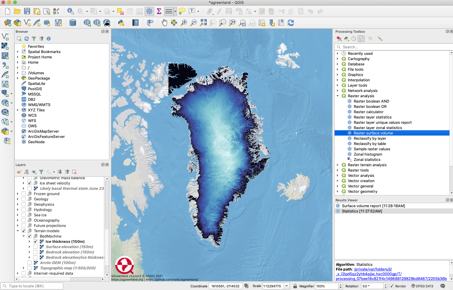
QGreenland runs on the free and open source QGIS software (www.qgis.org). The User Guide included in the QGreenland download package explains the basics of QGIS and how to use some of the built-in tools to explore and analyze QGreenland data. Here is a sneak peak of the topics covered in the QGreenland User Guide:
- Tour the QGIS interface (toolbars, panels, map view, and more)
- Interact with QGreenland data layers
- Learn to use the Processing Toolbox to analyze or query QGreenland data
- Import GPS or other GNSS data into your QGreenland project
- Create new data layers from scratch
- Design a map for print or publication
Looking for QGreenland video tutorials? Subscribe to the QGreenland YouTube channel to learn more about working with QGreenland data and QGIS functionality as we add tutorial video content in coming months.
Learn to Use QGIS
The QGreenland User Guide is not meant to be a comprehensive QGIS manual. For more general QGIS information and advanced tutorials, check out these resources:
Teach with QGreenland
GIS can be a powerful teaching and learning tool. Using GIS in a secondary or post-secondary classroom has been shown to increase students’ spatial thinking and higher-order learning skills. QGIS is a particularly useful GIS platform for educational use because it is free and open source; thus students anywhere can download the software onto their computer or laptop without having to pay for a license. And once downloaded, both QGIS and the QGreenland data package run offline, eliminating concerns about limited bandwidth or unstable internet connections in classrooms, at home, or in the field.
QGreenland supports a wide variety of science learning topics, skills, and practices, including but not limited to:
- Earth's systems and climate
- Cryospheric and hydrologic processes
- Arctic processes and ecosystems
- Spatial and temporal change
- Modeling and using model data
- Analyzing and interpreting data
The QGreenland education team is planning a series of educator-focused workshops on how to use QGreenland in the classroom. Check back here or the QGreenland Events and News page to find upcoming workshops, or sign up for the QGreenland newsletter. Is there a topic you'd like to learn more about either through an online tutorial video or at a QGreenland educator workshop? Email us at qgreenland.info@gmail.com.